
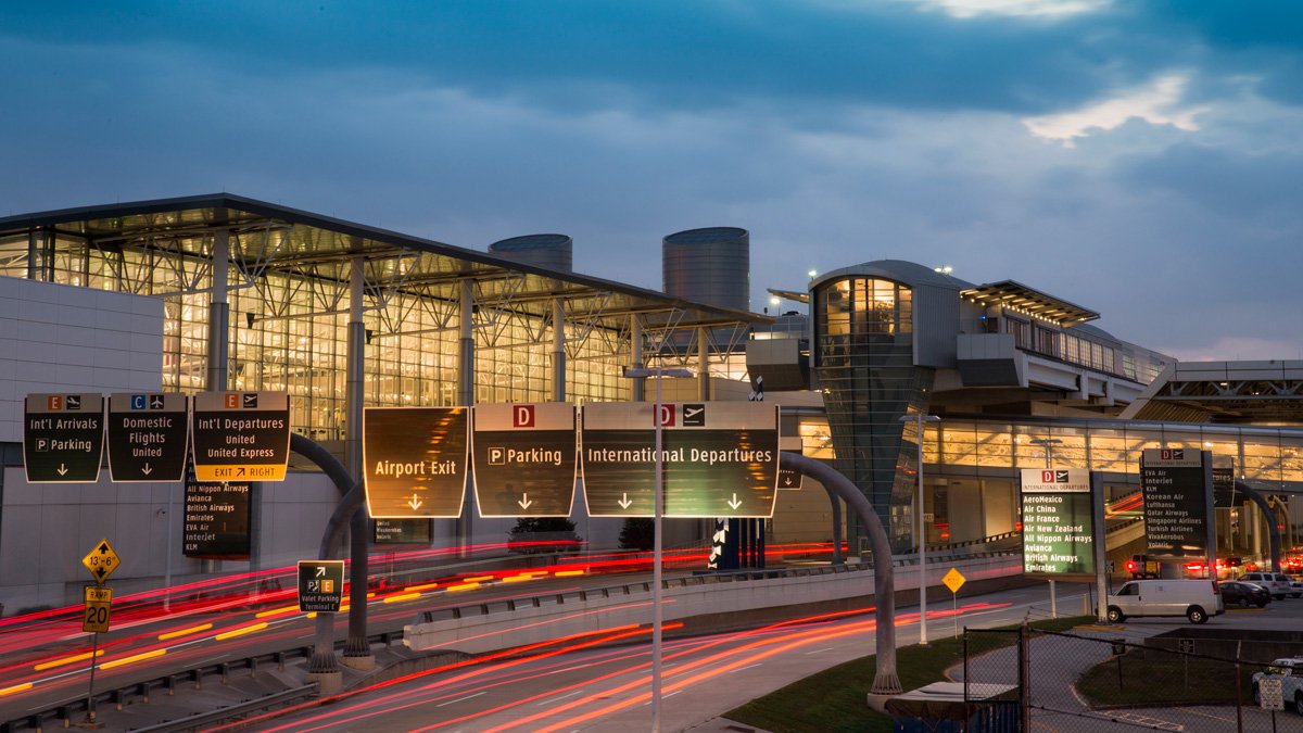
George Bush Intercontinental (IAH) is the biggest international airport in Houston. Its huge size means passengers sometimes get lost between terminals. No worries, this quick terminal map guide is here to help you out. A good terminal map does a lot more than just show your location. It can save you time on your flight by showing you the fastest paths between gates. In this blog, we will show you how to read and understand any layout quickly. So, this simple map guide about the George Bush Intercontinental Airport is all you need to turn your stressful rush into a totally relaxed walk.
Why the IAH Airport Map Is Useful
You will not have to waste your time walking around the IAH Airport aimlessly trying to find your way. We know that this airport is huge, with multiple terminals, each with several floors. However, this map is a great tool for understanding the airport layout before you even arrive.
Checking the map beforehand helps you to explore the terminal with ease. It marks all the important landmarks. These include:
- Restaurants
- Shops
- Places to relax
- Airlines
- Car Parking locations
- Real-time security wait times
- Public Art and more
Learn About George Bush Intercontinental Airport Map Terminal Guide Through the Interactive Map
George Bush Intercontinental Airport has five primary terminals: A, B, C, D, and E. Every terminal features many restaurant and cafe options, retail shops, comfortable lounges, and other facilities. The IAH airport’s simple layout makes it easy to get from check-in to baggage claim.
To save even more time, you can use the interactive map on your phone without any hassle. It gives you live, step-by-step directions through all five terminals, just like a personal GPS. You can instantly check security wait times, see exactly how long it takes to walk to your gate, and find nearby food, restrooms, or shops without any guesswork.
IAH Airport Security Checkpoint:
Getting around IAH Airport can feel like a workout since it has five big terminals. Your best bet is to use their interactive map, which tracks security checkpoints in real time. Knowing how to use the map and watching the live wait times are the ultimate tricks for cutting out stress and making it to your gate easily.
| Terminal | Checkpoint Name & Type | Current Wait Time |
| Terminal A | IAH Terminal A North Standard | 7 min |
| Terminal A | IAH Terminal A North PreCheck | 15 min |
| Terminal A | IAH Terminal A South Standard | 12 min |
| Terminal C | IAH Terminal C North PreCheck | 3 min |
| Terminal C | IAH Terminal C North Premier | 3 min |
| Terminal C | IAH Terminal C South Standard | 9 min |
| Terminal D | IAH Terminal D Standard | 5 min |
| Terminal E | IAH Terminal E Standard | 7 min |
| Terminal E | IAH Terminal E PreCheck | 5 min |
Make Your Way Through the IAH Terminal Using the Interactive Map:
The IAH Airport map makes it easy to find rides outside the airport. To do this, it highlights all the shuttle stops and parking areas. Furthermore, it easily points the way to transit stations and car rental facilities.
- Skyway:
The Skyway at George Bush Airport (IAH) is a free, above-ground train that connects all five terminals while you are inside security. It runs every two minutes, is wheelchair accessible, and takes less than five minutes to travel from Terminal A to Terminals D/E. When you have the map at hand, finding the Skyway becomes easier and seamless. Follow the signage.
- Pick Up & Drop Off
Drivers can pick you up outside Arrivals at doors A-113, B-101, C-102, or 103B for E.
If you land at Terminal D, please head to E. Check the digital map to locate your pick-up and drop-off points. This way, it will be immensely helpful.
- Taxis & Ride Apps:
To find your ride easily, you must check out the airport’s interactive digital map. It shows you the exact pickup zones and taxi lines. Official taxis and rideshares run 24/7 right outside Terminals A, C, and E. If you need help, look for the airport team or use a nearby courtesy phone. Even better, it gives you step-by-step walking directions right from your baggage carousel to the curb so that you won’t get lost after your long flight.
- Limousines & Sedans:
Your pre-booked limo or luxury car will be waiting at baggage claim or at Terminal E, Door 103. If you land at Terminal D from an international flight, please walk to Terminal E after customs. You won’t get lost as the terminal map shows the exact pickup locations. So, just follow the map to walk straight to your driver without any hassle.
- Shuttles & Buses:
You will find the following options at IAH Airport, which ensure safe, hassle-free travel.
- Of-airport parking shuttles
- Hotel Shuttles
- Cruise and charter buses
- Shuttles to get transported to the rental car centers and more
The map clearly highlights the shuttle and bus locations at the IAH Airport to ensure you have a convenient time ahead.
- Rental Cars:
All rental car companies share a single consolidated facility located just five minutes away from the main terminals. To get there, a digital airport map helps you navigate directly to the nearest free shuttle pick-up station outside your terminal. The map provides a clear visual route and real-time shuttle bus tracking, ensuring a seamless, stress-free transition to the rental center.
- Parking Services:
The IAH parking map makes finding a spot easy. Here are the parking options you will find with the help of the airport’s interactive map:
- Valet Parking
- Parking Plus
- Economy Parking (ecopark2)
- EV Charging Stations
Find Your Airline Quickly at IAH Airport with This Map
IAH is a huge airport with flights to destinations around the world. To keep from getting lost, just open the IAH Airport map to see exactly which terminal your airline uses. It has everything from low-cost flights to big international airlines, and the map makes finding yours simple.
| Airline | Phone Number |
| AeroMéxico | 1-800-237-6639 |
| Air New Zealand | 1-800-262-1234 |
| American Airlines | 1-800-621-8489 |
| Air Canada | 1-800-296-3408 |
| Air China | NA |
| Air France | 1-800-237-2747 |
| All Nippon Airways | 1 (800) 235-9262 |
| Avianca – Aerovías Nacionales de Colombia | NA |
| British Airways | 1-800-247-9297 |
| Delta Airlines | 1-800-455-2720 |
| Emirates | NA |
| EVA Air | NA |
| Frontier Airlines | 1-801-401-9000 |
| ITA Airways | 1 877 793 1717 |
| JetBlue Airways | NA |
| KLM Royal Dutch Airlines | NA |
| Lufthansa | NA |
| Qatar Airways | NA |
| Turkish Airlines | NA |
| United Airlines | NA |
| VIVA Aerobus | NA |
| Volaris | NA |
| WestJet | NA |
| ZIPAIR | NA |
How to Read the IAH Airport Map with Ease?
Follow these easy steps to enjoy a smoother journey.
- Check Your Terminal First: Always confirm your terminal before looking at the map. IAH has five terminals (A through E), and knowing which one yours is narrows down your map view instantly.
- Select your exact level: Terminals have different floors for check-in, arrivals, and gates. Toggle between levels on the map to see exactly what is on your floor.
- Filter what you need: Do not look at everything at once. Use the filters to show only restaurants, shops, restrooms, or charging stations to clear up the screen.
- Search for your gate: Check your gate number directly into the search bar. The map will instantly pinpoint it, saving you from wandering around the terminal aimlessly.
- Follow the Skyway or the Subway: Use the map to spot the trains. Use the Subway before security, or the elevated Skyway after security, to move between terminals quickly.
- Locate the Central Core: Every terminal has a central hub where food, shops, and gates are spread out. Find this central core on your map to orient yourself easily.
- Track the Signage Icons: The map icons match the physical signs in the airport. Look for matching symbols for baggage claim, ground transport, or restrooms to stay on track.
Now you know that the best tool is the IAH Airport’s interactive airport map. It shows you real-time security wait times, helps you find your specific gate at your terminal, and guides you to your airline. Need to change terminals on the free Skyway train? Or looking for a taxi outside? This digital guide has you covered. So, save the map, select your filters, and enjoy a totally relaxed walk to your destination.
FAQs
IAH Airport, also known as George Bush Intercontinental Airport, is located in Houston, Texas. It sits about 23 miles north of downtown Houston, right between Interstate 45 and Interstate 69.
There are five passenger terminals at George Bush Intercontinental Airport (IAH). They are named Terminal A, B, C, D, and E, all connected by trains.
You can use this map to easily find your terminals, gates, parking, ground transportation options, security checkpoints, and baggage claim area at IAH Airport without any hassle.
Yes! The interactive airport map tracks security checkpoint lines in real time across all terminals. Checking these live updates on your phone is the ultimate trick to cutting out stress and making it to your gate easily.
You can use the free, above-ground Skyway train if you are already inside security; it connects all five terminals in less than five minutes. If you are outside security, use the Subway train to move between terminals.